List · 51 mapped
Treks and hikes in Switzerland
51 places with a mapped walking route each, on one map: distance, climb, time and a free GPX on every page. Most searched first, from Matterhorn (4,478 m).
Treks and hikes in Switzerland on the map
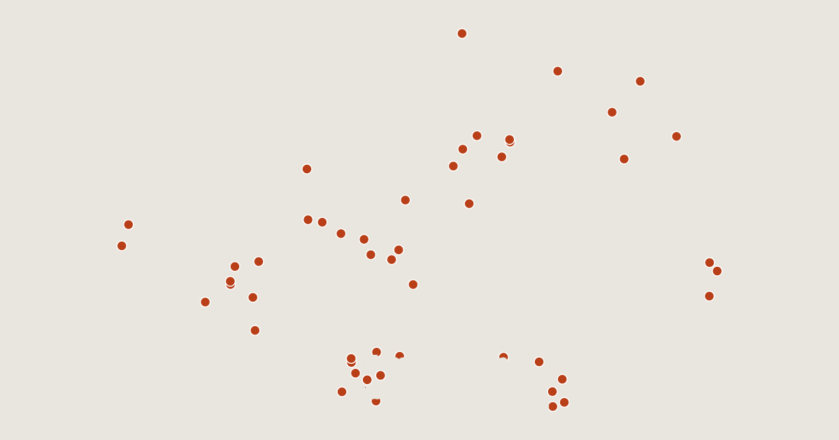
51 routes on the list
Most searched first. Each page has the route's distance, climb, time and a GPX.
- 1MatterhornAosta Valley, Italy3.6 km · +1,545 m · about 3.5 h · T44,478 mGPX
- 2RigiCanton of Schwyz, Switzerland1.2 km · +287 m · about 1 h · T41,797 mGPX
- 3EigerCanton of Berne, Switzerland2.5 km · +49 m · about 0.5 h · T2 Ends 1,910 m below the summit.3,967 mGPX
- 4JungfrauCanton of Valais, Switzerland6.6 km · +2,251 m · about 5.5 h · T4 Ends 940 m below the summit.4,158 mGPX
- 5Grosser MythenCanton of Schwyz, Switzerland1.8 km · +635 m · about 1.5 h · T31,898 mGPX
- 6Rochers de NayeCanton of Vaud, Switzerland2.4 km · +444 m · about 1.5 h · T22,042 mGPX
- 7FronalpstockCanton of Schwyz, Switzerland2.9 km · +480 m · about 1.5 h · T21,920 mGPX
- 8GornergratCanton of Valais, Switzerland3.4 km · +641 m · about 2 h · T23,135 mGPX
- 9PizolCanton of St. Gallen, Switzerland6.2 km · +1,016 m · about 3 h · T42,844 mGPX
- 10Brienzer RothornCanton of Lucerne, Switzerland2.9 km · +523 m · about 1.5 h · T22,349 mGPX
- 11DufourspitzeCanton of Valais, Switzerland9.3 km · +1,805 m · about 5.5 h · T64,634 mGPX
- 12SchilthornCanton of Berne, Switzerland1.3 km · +309 m · about 1 h · T22,970 mGPX
- 13StanserhornCanton of Nidwalden, Switzerland2.6 km · +548 m · about 1.5 h · T21,898 mGPX
- 14BürgenstockCanton of Nidwalden, Switzerland0.8 km · +133 m · about 0.5 h · T21,128 mGPX
- 15Dent de JamanCanton of Vaud, Switzerland0.7 km · +147 m · about 0.5 h · T51,875 mGPX
- 16NiesenCanton of Berne, Switzerland2.9 km · +569 m · about 1.5 h · T22,362 mGPX
- 17Hoher KastenCanton of Appenzell Innerrhoden, Switzerland0.9 km · +111 m · about 0.5 h · T51,794 mGPX
- 18Monte GenerosoCanton of Ticino, Switzerland0.6 km · +90 m · about 0.5 h · T11,701 mGPX
- 19Monte San SalvatoreCanton of Ticino, Switzerland1.8 km · +296 m · about 1 h · T2912 mGPX
- 20MorgenberghornCanton of Berne, Switzerland2.4 km · +660 m · about 1.5 h · T32,249 mGPX
- 21WeisshornCanton of Valais, Switzerland9.7 km · +3,103 m · about 7.5 h · T64,505 mGPX
- 22Monte San GiorgioCanton of Ticino, Switzerland1.6 km · +415 m · about 1 h · T21,097 mGPX
- 23Monte TamaroCanton of Ticino, Switzerland1.4 km · +197 m · about 0.5 h · T21,962 mGPX
- 24Dent de VaulionCanton of Vaud, Switzerland0.5 km · +67 m · about 0.5 h · T21,483 mGPX
- 25Le GrammontCanton of Valais, Switzerland0.7 km · +160 m · about 0.5 h · T52,172 mGPX
- 26OberrothornCanton of Valais, Switzerland1.8 km · +406 m · about 1 h · T33,414 mGPX
- 27StockhornCanton of Berne, Switzerland3.1 km · +452 m · about 1.5 h · T32,190 mGPX
- 28Monte BogliaCanton of Ticino, Switzerland1.5 km · +240 m · about 1 h · T21,516 mGPX
- 29MettelhornCanton of Valais, Switzerland8.8 km · +1,857 m · about 5.5 h · T53,406 mGPX
- 30ChäserruggCanton of St. Gallen, Switzerland3.6 km · +672 m · about 2 h · T22,260 mGPX
- 31Muottas MuraglCanton of the Grisons, Switzerland2.7 km · +340 m · about 1 h · T22,453 mGPX
- 32GantrischCanton of Berne, Switzerland2.8 km · +429 m · about 1.5 h · T22,175 mGPX
- 33Mont TendreCanton of Vaud, Switzerland0.9 km · +55 m · about 0.5 h · T11,679 mGPX
- 34EggishornCanton of Valais, Switzerland3.5 km · +648 m · about 2 h · T22,926 mGPX
- 35BishornCanton of Valais, Switzerland13 km · +2,496 m · about 7.5 h · T54,149 mGPX
- 36SchnebelhornCanton of Zurich, Switzerland0.6 km · +140 m · about 0.5 h · T21,291 mGPX
- 37Kleiner MythenCanton of Schwyz, Switzerland1.8 km · +635 m · about 1.5 h · T31,811 mGPX
- 38Pic ChaussyCanton of Vaud, Switzerland2.4 km · +493 m · about 1.5 h · T22,351 mGPX
- 39Piz LanguardCanton of the Grisons, Switzerland6.8 km · +1,089 m · about 3.5 h · T33,262 mGPX
- 40GurtenCanton of Berne, Switzerland0.5 km · +29 m · about 0.5 h858 mGPX
- 41Piz BerninaCanton of the Grisons, Switzerland9.7 km · +2,083 m · about 6 h · T64,048 mGPX
- 42SchesaplanaCanton of the Grisons, Switzerland6.2 km · +1,098 m · about 3.5 h · T32,965 mGPX
- 43LägernCanton of Aargau, Switzerland1.4 km · +76 m · about 0.5 h · T2866 mGPX
- 44AllalinhornCanton of Valais, Switzerland8.0 km · +1,655 m · about 5 h · T64,027 mGPX
- 45WeissmiesCanton of Valais, Switzerland6.2 km · +1,543 m · about 4 h · T64,013 mGPX
- 46Grand MuveranCanton of Valais, Switzerland4.6 km · +1,049 m · about 3 h · T53,051 mGPX
- 47Dent de LysCanton of Fribourg, Switzerland2.1 km · +437 m · about 1.5 h · T32,014 mGPX
- 48GridoneCanton of Ticino, Switzerland3.1 km · +629 m · about 2 h · T32,188 mGPX
- 49Vanil NoirCanton of Fribourg, Switzerland3.9 km · +1,162 m · about 3 h · T32,389 mGPX
- 50BigerhornCanton of Valais, Switzerland10 km · +2,415 m · about 6.5 h · T53,626 mGPX
- 51TitlisCanton of Berne, Switzerland4.2 km · +1,472 m · about 3.5 h · T4 Ends 580 m below the summit.3,238 mGPX
Related lists and places
More trek lists
- Treks and hikes in United States
- Treks and hikes in Italy
- Treks and hikes in the Alps
- Treks and hikes in the Andes
- Treks and hikes in United Kingdom
- Treks and hikes in Japan
- Treks and hikes in the Himalayas
- Treks and hikes in Australia
- Treks and hikes in Nepal
- Treks and hikes in Indonesia
- Treks and hikes in Spain
- Treks and hikes in Ireland