Also on the map ofVaud Prealps‹ Alps
Dent de Jaman
- Easiest route
- 0.7 km+147 m · about 0.5 h · T5
- Prominence
- 135 m443 ft
- Isolation
- 0.9 km
- Tonight
- -4°CSnow · Wind 13 km/h SW
Dent de Jaman is a 1,875 m (6,152 ft) mountain in the Vaud Prealps, Canton of Vaud, Switzerland.
All facts
- Elevation
- 1,875 m · 6,152 ft
- Nearest higher peak
- Rochers de Naye (2,042 m)
- Range
- Vaud Prealps
- Region
- Canton of Vaud, Switzerland
- Coordinates
- 46.4449° N, 6.9749° E
How to get to the top of Dent de Jaman
3 mapped routes from where a car can get you. None is a walk: expect scrambling, snow or glacier.
Easiest route: from Road end, 0.5 km SSE of Dent de Jaman
- Distance
- 0.7 kmone way
- Climb
- +147 m−5 m (482 ft up)
- Time up
- about 0.5 h
- Difficulty
- T5Demanding alpine: scrambling, possible snow or glacier
Other routes 2
Routes © OpenStreetMap contributors, available under the ODbL. Climb from the terrain model. Trails change and maps miss things: check conditions locally.
Dent de Jaman 3D map
Drag to orbit · click, then scroll to zoom (or Ctrl/⌘ + scroll) · One finger scrolls the page · two fingers orbit and zoom · 6 × 6 km
Dent de Jaman terrain and contours
50 m contours from the Copernicus GLO-30 terrain model. The route drawn is the easiest mapped one. Click two points on the map to draw your own cross-section.Tap two points on the map to draw your own cross-section.
West → east through the summit
Dent de Jaman weather
Tonight · Snow · -4°C (25°F) · 2.9 mm · Wind 13 km/h SW
Dent de Jaman forecast for the summit, about 1,875 m.
- Tonight-4°2.9 mm13 km/h SW
- Today-3°-1°9.7 mm12 km/h SE
- Sun-4°4°15.2 mm17 km/h W
- Mon-3°7°–7 km/h E
- Tue2°12°–4 km/h E
- Wed1°8°0.2 mm7 km/h NW
- Thu1°7°–6 km/h NW
- Fri0°8°–5 km/h W
- Sat-1°6°1.4 mm5 km/h W
- Sun-1°2°6.6 mm5 km/h NW
Forecast data: MET Norway, CC BY 4.0; daily low and high, precipitation total and strongest wind from the hourly data, model run Oct 23, 23:19 UTC.
Camping & parking near Dent de Jaman
Campsites, parking, trailheads and mountain huts mapped in OpenStreetMap around Dent de Jaman, nearest first, by straight-line distance. Check access, fees and permits locally.
Nearest parking
Col de Jaman
Nearest hut
Cabane de Jaman
Nearest campsite
Les Horizons Bleus
Nearest caravan site
Stellplatz Villeneuve
All mapped places 9
| Place | Distance |
|---|---|
| Col de JamanParking | 0.7 km NNE |
| Cabane de JamanHut | 1.0 km N |
| Chalet de SautodozHut | 1.8 km S |
| Parking | 2.2 km WNW |
| Parking | 2.5 km WSW |
| Chalet La PlaniazHut | 2.5 km NNW |
| Les Horizons BleusCampsite | 6.9 km SW |
| Stellplatz VilleneuveCaravan site | 7.2 km SSW |
| Stellplatz Joncs, Châtel-Saint-DenisCaravan site | 7.8 km NNW |
How steep is the route to Dent de Jaman?
The easiest mapped route, 0.7 km from 1,706 m to 1,875 m. Steepest stretch: 27°.
- 0–15°0.5 km
- 15–30°0.2 km
Grades are averaged between profile points about 10 m apart, so short steeper steps don’t show.
Land cover
ESA WorldCover 10 m classification of the same area.
Snow & ice means glaciers and year-round snow (a yearly average), not today’s snow cover.
Nearby summits
Named peaks within 3 km, measured from the Dent de Jaman summit.
Summit list 9
- 1Le Merdasson1,860 m 0.8 km S
- 2Grande Chaux de Naye1,982 m 1.0 km SE
- 3Dent de Hautadon1,871 m 1.1 km E
- 4Rochers de Naye2,042 m 1.5 km S
- 5Les Coursis1,864 m 1.6 km NNE
- 6Les Dentaux1,715 m 2.4 km SSW
- 7Corbé1,898 m 2.5 km N
- 8Le Débandit1,529 m 2.7 km NW
- 9Cape au Moine1,941 m 2.8 km N
Wildlife seen nearby
Sightings of the most-seen species on iNaturalist (research grade) within 3 km; 758 species recorded in all.
Sightings per species 6
- Yellow-billed Chough32
- Great Yellow Gentian27
- Poet's Narcissus25
- Yellow Foxglove21
- Red campion19
- Bladder campion17
Where Dent de Jaman sits
- Range
- Alps751Western Alps353Northwestern Alps309Swiss Prealps46Vaud and Freiburger Prealps10Vaud Prealps4
- Region
- Canton of Vaud18Switzerland432Europe2,143
Nearby places
 Rochers de NayePeak · 2,042 m↑1.5 km S
 Cape au MoinePeak · 1,941 m↑2.8 km N
 Dent de LysPeak · 2,014 m↑7.3 km NNE
 MolésonPeak · 2,002 m↑12 km NNE
 Pic ChaussyPeak · 2,351 m↑13 km SE
More in the Vaud Prealps 1
Dent de Jaman downloads: topographic map, heightmap, STL 3D model and DEM
Free files made in your browser from this page's terrain data. No sign-up; credit the sources below.
Print & wall
3D printing & 3D apps
Free to use with credit: see the data sources
How accurate is this?
24 m low This 3D map reads 1,851 m at the summit; the official height is 1,875 m.
Why: a 30 m terrain model averages each cell, so a sharp summit gets rounded off. The 90 m model misses by 42 m.
| Source | Summit | Difference |
|---|---|---|
| Official height (Wikidata) | 1,875 m | — |
| Copernicus GLO-30 (used on this page) | 1,851 m | -24 m |
| Copernicus GLO-90 | 1,833 m | -42 m |
Data sources
- Terrain
- Produced using Copernicus WorldDEM-30 © DLR e.V. 2010-2014 and © Airbus Defence and Space GmbH 2014-2018 provided under COPERNICUS by the European Union and ESA; all rights reserved. The European Union, ESA, DLR and Airbus incur no liability for any use of this data and do not endorse this service.
- Imagery
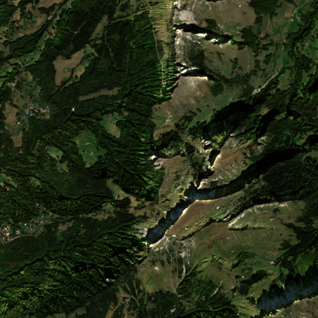
- Contains modified Copernicus Sentinel data 2026 (scene 2026-09-22)
- Land cover
- © ESA WorldCover project 2021 / Contains modified Copernicus Sentinel data (2021) processed by ESA WorldCover consortium
- Facts
- Wikidata (CC0)
- Routes, Camping & parking
- © OpenStreetMap contributors (ODbL)
- Summits
- © OpenStreetMap contributors, via Overture Maps Foundation (ODbL)
- Wildlife
- iNaturalist community observations, counts only
- Accuracy comparison, Panorama
- Includes Copernicus WorldDEM-90 © DLR e.V. 2010-2014 and © Airbus Defence and Space GmbH 2014-2018 provided under COPERNICUS by the European Union and ESA; all rights reserved. The European Union, ESA, DLR and Airbus incur no liability for any use of this data and do not endorse this service.
- Forecast
- Weather forecast from MET Norway (CC BY 4.0)
- Sources
- Wikidata · OpenStreetMap · GeoNames · Wikipedia