Also on the map ofSavoy Prealps‹ Alps
Chamechaude
- Easiest route
- 2.6 km+723 m · about 2 h · T4
- Prominence
- 1,771 m5,810 ft
- Tonight
- -4°CLight snow · Wind 5 km/h E
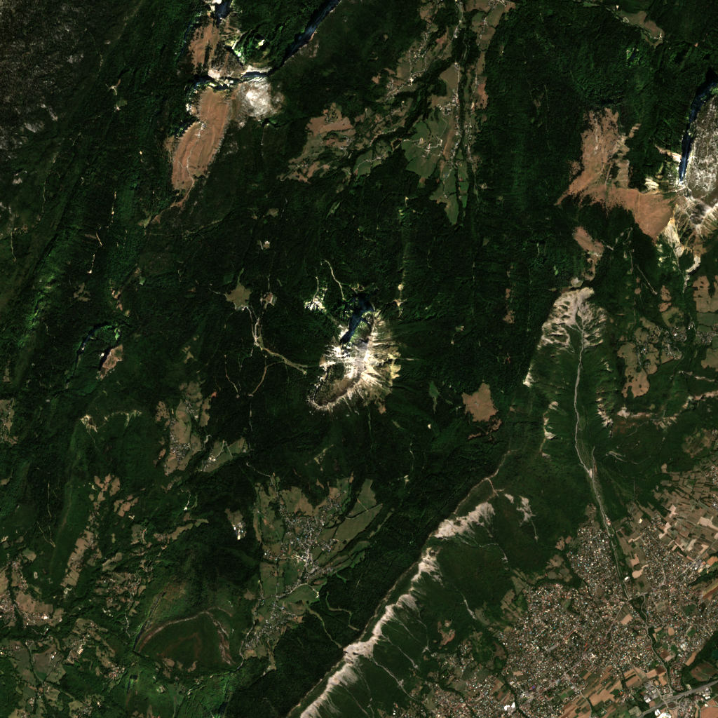
Chamechaude is a 2,082 m (6,831 ft) mountain in the Chartreuse Mountains, canton of Saint-Laurent-du-Pont, France.
All facts
- Elevation
- 2,082 m · 6,831 ft
- Range
- Chartreuse Mountains
- Region
- canton of Saint-Laurent-du-Pont, France
- Coordinates
- 45.2874° N, 5.7874° E
How to get to the top of Chamechaude
3 mapped walking routes from where a car can get you, with distance and climb from the terrain model.
Easiest route: from Road end, 1.5 km WSW of Chamechaude
- Distance
- 2.6 kmone way
- Climb
- +723 m−28 m (2,372 ft up)
- Time up
- about 2 h
- Difficulty
- T4Alpine: faint path, hands needed in places
Other routes 2
Routes © OpenStreetMap contributors, available under the ODbL. Climb from the terrain model. Trails change and maps miss things: check conditions locally.
Chamechaude 3D map
Drag to orbit · click, then scroll to zoom (or Ctrl/⌘ + scroll) · One finger scrolls the page · two fingers orbit and zoom · 11 × 11 km
Chamechaude terrain and contours
100 m contours from the Copernicus GLO-30 terrain model. The route drawn is the easiest mapped one. Click two points on the map to draw your own cross-section.Tap two points on the map to draw your own cross-section.
West → east through the summit
Chamechaude weather
Tonight · Light snow · -4°C (25°F) · 0.9 mm · Wind 5 km/h E
Chamechaude forecast for the summit, about 2,082 m. Summit vs base: the Base line is for about 1,305 m.
- Tonight-4°0.9 mm5 km/h EBase 0°
- Today-5°6°7.3 mm6 km/h WBase 0 / 10°
- Fri-3°1°5.6 mm6 km/h WBase 2 / 6°
- Sat-4°2°–6 km/h SWBase 0 / 7°
- Sun-6°4°–3 km/h NBase -1 / 9°
- Mon-2°6°0.5 mm5 km/h SBase 2 / 11°
- Tue1°3°1.2 mm2 km/h SEBase 5 / 8°
- Wed1°8°9.4 mm5 km/h SBase 5 / 13°
- Thu2°9°9.7 mm5 km/h SBase 7 / 14°
- Fri-1°5°6.8 mm3 km/h SEBase 3 / 9°
Forecast data: MET Norway, CC BY 4.0; daily low and high, precipitation total and strongest wind from the hourly data, model run Nov 5, 01:17 UTC.
Camping & parking near Chamechaude
Campsites, parking, trailheads and mountain huts mapped in OpenStreetMap around Chamechaude, nearest first, by straight-line distance. Check access, fees and permits locally.
Nearest campsite
0.7 km SSE
Nearest hut
Habert de Chamechaude
Nearest parking
1.5 km W
Nearest caravan site
Saint-Pierre-de-Chartreuse, Le Couzon
All mapped places 10
| Place | Distance |
|---|---|
| Campsite | 0.7 km SSE |
| Habert de ChamechaudeHut | 0.9 km SSE |
| Cabane forestière de VelouzeHut | 1.3 km S |
| Parking | 1.5 km W |
| Parking | 1.6 km WNW |
| Parking | 1.6 km WNW |
| La ViretteCampsite | 3.1 km SSW |
| Camping de MartinièreCampsite | 4.4 km N |
| Habert de PravoutaHut | 4.7 km NE |
| Saint-Pierre-de-Chartreuse, Le CouzonCaravan site | 6.5 km NNE |
How steep is the route to Chamechaude?
The easiest mapped route, 2.6 km from 1,305 m to 2,082 m. Steepest stretch: 48°.
- 0–15°1.1 km
- 15–30°1.3 km
- 30–45°0.1 km
Grades are averaged between profile points about 30 m apart, so short steeper steps don’t show.
Land cover
ESA WorldCover 10 m classification of the same area.
Snow & ice means glaciers and year-round snow (a yearly average), not today’s snow cover.
Nearby summits
Named peaks within 5.5 km, measured from the Chamechaude summit.
Summit list 8
- 1Bec Charvet1,738 m 3.4 km ENE
- 2Montvernet1,630 m 3.4 km W
- 3Montfromage1,662 m 3.6 km WNW
- 4Canaple1,703 m 3.8 km NW
- 5Pinéa1,771 m 3.8 km W
- 6Charmant Som1,867 m 4.6 km NNW
- 7Pravouta1,760 m 4.6 km NE
- 8Roc d'Arguille1,768 m 5.1 km NE
Wildlife seen nearby
Sightings of the most-seen species on iNaturalist (research grade) within 5.5 km; 1,078 species recorded in all.
Sightings per species 6
- Yellow-billed Chough93
- Northern Chamois40
- Elder-flowered Orchid38
- Small Tortoiseshell31
- Early Purple Orchid27
- Great Yellow Gentian26
Where Chamechaude sits
- Range
- Alps764Western Alps355Northwestern Alps310Savoy Prealps16
Nearby places
 Grésivaudan230 m↑13 km ENE
 Lac de PaladruLake · 492 m↑27 km NW
 Lac d'AiguebeletteLake · 373 m↑30 km N
 Col du GlandonPass · 1,924 m↑31 km E
 Oisans1,386 m↑33 km SE
More in the Savoy Prealps 6
Chamechaude downloads: topographic map, heightmap, STL 3D model and DEM
Free files made in your browser from this page's terrain data. No sign-up; credit the sources below.
Print & wall
3D printing & 3D apps
Free to use with credit: see the data sources
How accurate is this?
76 m low This 3D map reads 2,006 m at the summit; the official height is 2,082 m.
Why: a 30 m terrain model averages each cell, so a sharp summit gets rounded off. The 90 m model misses by 85 m.
| Source | Summit | Difference |
|---|---|---|
| Official height (Wikidata) | 2,082 m | — |
| Copernicus GLO-30 (used on this page) | 2,006 m | -76 m |
| Copernicus GLO-90 | 1,997 m | -85 m |
Data sources
- Terrain
- Produced using Copernicus WorldDEM-30 © DLR e.V. 2010-2014 and © Airbus Defence and Space GmbH 2014-2018 provided under COPERNICUS by the European Union and ESA; all rights reserved. The European Union, ESA, DLR and Airbus incur no liability for any use of this data and do not endorse this service.
- Imagery
- Contains modified Copernicus Sentinel data 2026 (scene 2026-09-03)
- Land cover
- © ESA WorldCover project 2021 / Contains modified Copernicus Sentinel data (2021) processed by ESA WorldCover consortium
- Facts
- Wikidata (CC0)
- Routes, Camping & parking
- © OpenStreetMap contributors (ODbL)
- Summits
- © OpenStreetMap contributors, via Overture Maps Foundation (ODbL)
- Wildlife
- iNaturalist community observations, counts only
- Accuracy comparison, Panorama
- Includes Copernicus WorldDEM-90 © DLR e.V. 2010-2014 and © Airbus Defence and Space GmbH 2014-2018 provided under COPERNICUS by the European Union and ESA; all rights reserved. The European Union, ESA, DLR and Airbus incur no liability for any use of this data and do not endorse this service.
- Forecast
- Weather forecast from MET Norway (CC BY 4.0)
- Sources
- Wikidata · OpenStreetMap · GeoNames · Wikipedia